


Forget DeLoreans! A map, a full tank of gas, and the Ice Age Floods Geological Trail are all you need to transform a scenic Washington drive into a journey through time around Wenatchee. As you follow the path of prehistoric floods, you’ll witness first-hand the aftermath of their cataclysmic forces that carved deep canyons, scattered massive boulders, and forged a valley now renowned for its flourishing apple orchards and breathtaking vistas.
A Valley Forged by Mother Nature’s Chaos
Roughly 15,000 years ago, nature unleashed one of the most extraordinary geological events in Earth’s history, the Ice Age Floods. Originating from the catastrophic release of Montana’s glacial Lake Missoula (a body of water half the volume of Lake Michigan), floodwaters roared through the Pacific Northwest at speeds of up to 65 miles per hour and depths reaching 1,000 feet.
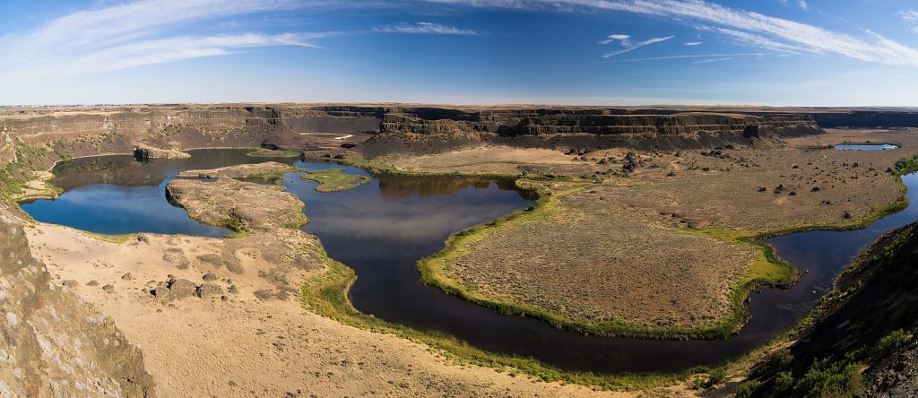
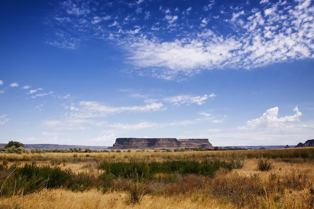
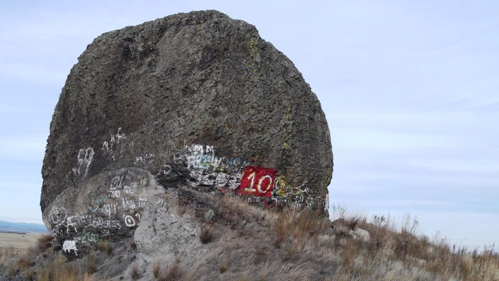
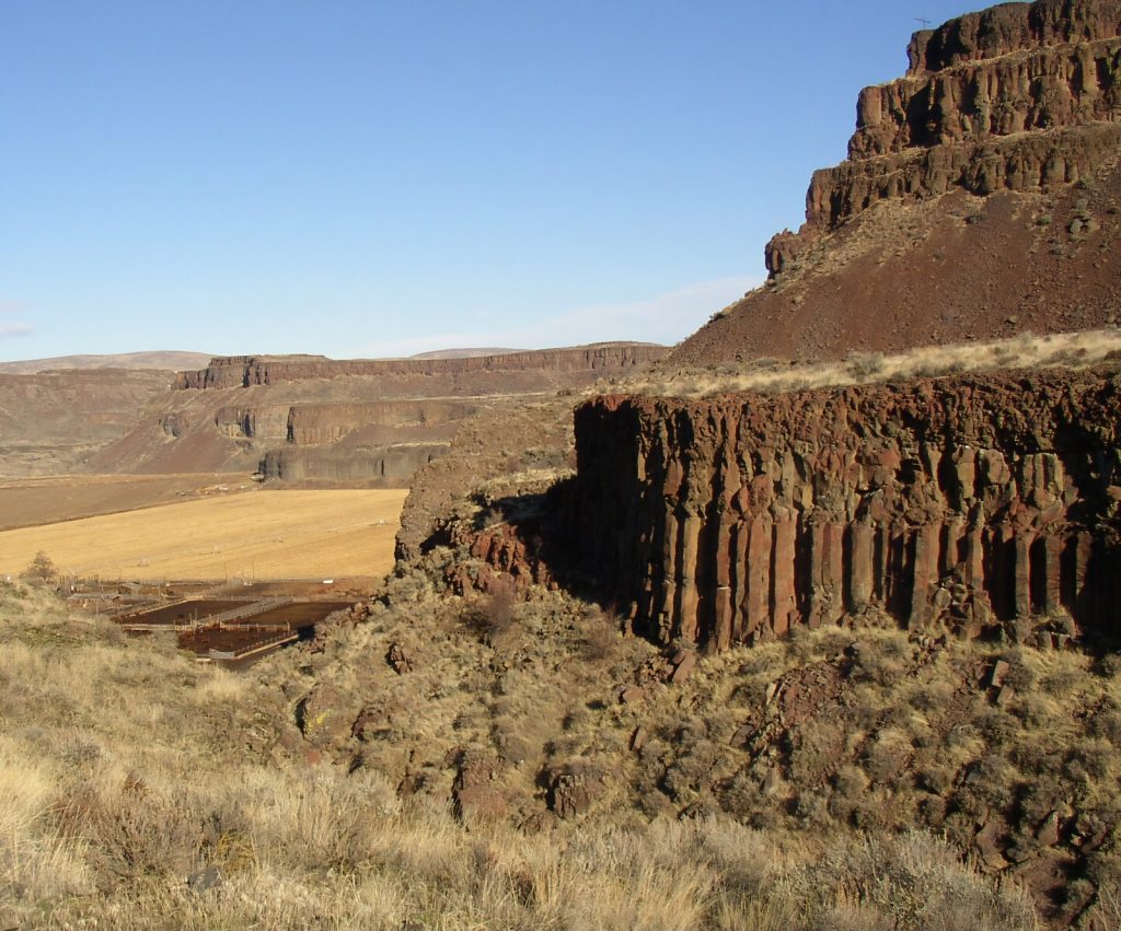
These floods didn’t just reshape the land. They created it. Torrents studded with icebergs hauling house-sized boulders scoured the land, carving deep canyons, depositing layers of sediment, and sculpting the valley’s iconic cliffs. But the floods’ reach didn’t stop there. Eroded soil from the region was even carried over 500 miles to the Pacific Ocean, reshaping the coastline itself.
When the floods subsided, they left behind a paradoxical gift of volcanic soils richer than any prairie, natural windbreaks carved into the hills, and the Columbia River’s lifeblood coursing through the valley. By the 1800s, early settlers already recognized its agricultural potential, with ingenious irrigation projects like the Highline Canal and Pipeline Bridge eventually turning the flood-scarred land into the fruit-growing powerhouse we know today.
The Ice Age Floods Geological Trail
To explore this trek through time, the Ice Age Floods Geological Trail spans Montana, Idaho, Washington and Oregon, inviting travelers to uncover the remnants of one of Earth’s most extraordinary natural events. Coordinated by the National Park Service, this trail system brings together interpretive centers, marked routes, and engaging points of interest to showcase the landscapes carved by these monumental floods. It is one of the most ambitious efforts to preserve and share geological history, with over 350 sightseeing stops along the way, eight of which are distinguished as National Natural Landmarks.
Take a Wild Ride on the Ice Age Side
In Wenatchee, visitors can follow two self-guided driving routes along the trail, featuring over 40 of these geological sites. The first, a 30-mile loop around the Wenatchee Valley, offers a concise yet captivating journey highlighting the floods’ local impact. Glacial erratics, ripple marks, and gravel bars serve as tangible reminders of the floods’ immense force and the way they reshaped the valley’s terrain. With clear signage and easy accessibility, this loop delivers a focused experience of Wenatchee’s glacial legacy.
The second route, known as the Ice Age Flood Loop, is a 164-mile loop through central Washington that provides a more expansive exploration of the floods’ far-reaching effects. This longer trail guides travelers through diverse landmarks, including dramatic canyons, sediment-rich formations, and sites like Dry Falls and Steamboat Rock State Park. Designed for those seeking a broader understanding of how the floods shaped the Pacific Northwest, this route delivers a comprehensive view of the geological forces that reshaped the region’s terrain over millennia.
Rewinding Earth’s Clock One Mile at a Time
The Ice Age Floods Geological Trail isn’t just a road trip. It’s a ride back to the past! Adventures can further be enhanced with available audio tours, like the one created by the Wenatchee Valley Museum & Cultural Center or the one provided by the National Park Service, both of which offer an engaging narration of the floods’ history and their impact on the region.
Whether you opt for Wenatchee’s bite-sized 30-mile loop or lose yourself in the 164-mile odyssey across Central Washington, every turn reveals a landscape sculpted by chaos and resilience, with the shorter Wenatchee Valley loop providing a quick dive into the region’s remarkable history, and the longer loop across central Washington allowing for a more comprehensive exploration. Either way, the trail lets you connect with a story so epic it’s written in stone!


